Shapefile of UK administrative counties
2012-10-25
Here is a shapefile of UK Administrative counties, which consists of England, Northern Ireland, Scotland and Wales. Below is the display inforamtion of this shapefile.
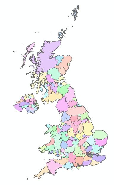
Data Type:	Shapefile Feature Class
Shapefile:	Map_UK.shp
Geometry Type:	Polygon

Projected Coordinate System:	WGS_1984_UTM_Zone_30N
Projection:	Transverse_Mercator
False_Easting:	500000.00000000
False_Northing:	0.00000000
Central_Meridian:	-3.00000000
Scale_Factor:	0.99960000
Latitude_Of_Origin:	0.00000000
Linear Unit: 	Meter

Geographic Coordinate System:	GCS_WGS_1984
Datum: 	D_WGS_1984
Prime Meridian: 	Greenwich
Angular Unit: 	Degree